
official data (USGS NEIC) · significant feed
USGS stamps an M6.4 in Papua New Guinea — significant feed, green alert
A reviewed USGS M6.4 hit under Papua New Guinea this morning — 49 km NNE of Kainantu, about 104 km deep — and landed on the official significant quake feed. PAGER alert is green. Tsunami flag is off. People nearby felt it.
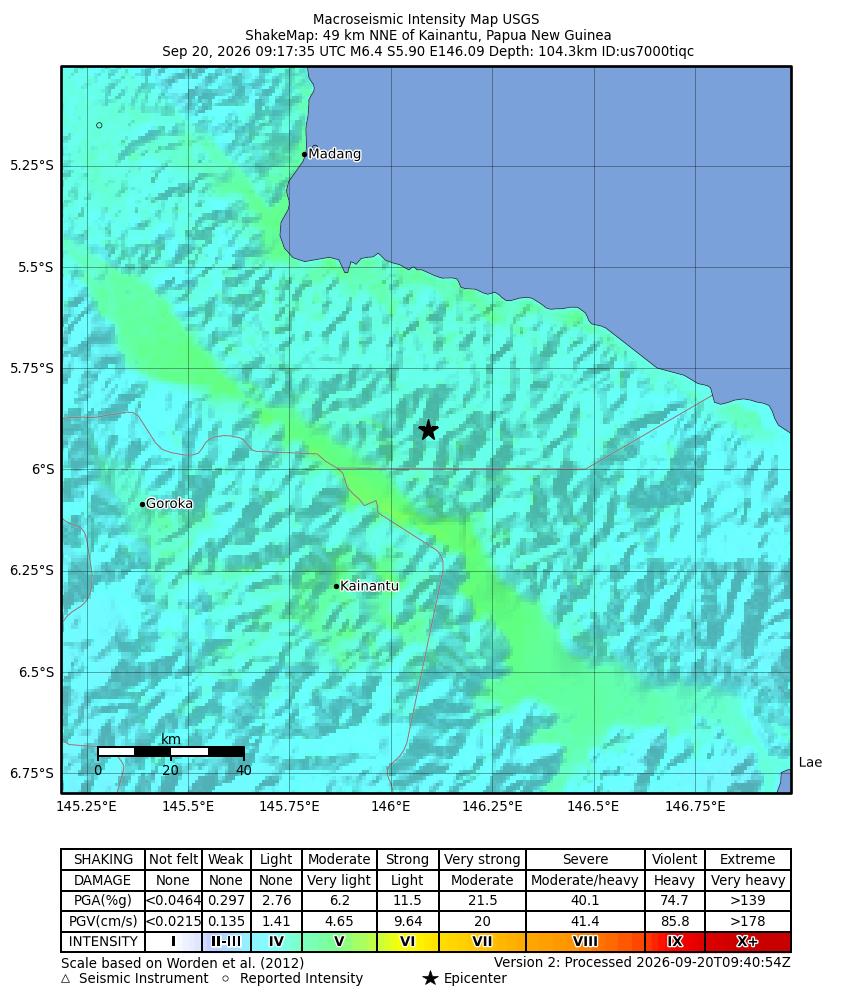
Key facts
- Event
- us7000tiqc · status reviewed · magType mww
- Preferred magnitude
- M 6.4 mww
- Origin
- 2026-09-20 09:17:35 UTC (~5:17 AM EDT)
- Epicenter
- 49 km NNE of Kainantu, Papua New Guinea · 146.0922°, −5.9021° · depth 104.329 km
- Products
- origin, phase-data, moment-tensor, DYFI, ShakeMap, ground-failure, PAGER
- Flags at fetch
- tsunami 0 · alert green · felt 16 · cdi 5.6 · mmi ~5.213 · sig 639
- Feeds
- USGS significant_hour + significant_day (official significant)
- Live
- Revisions → live USGS HUD / event page
M6.4 on the official significant feed, green PAGER, tsunami flag off — a big number that still reads as an intermediate-depth inland hit under PNG.
Desk reading of USGS us7000tiqc
Note
USGS reviewed event us7000tiqc puts a M6.4 mww at 09:17:35 UTC on September 20 — about 5:17 AM Eastern — 49 km NNE of Kainantu, Papua New Guinea, at depth 104.329 km. PAGER alert green. Tsunami flag 0. DYFI: 16 felt reports, CDI 5.6, MMI about 5.2. Significance 639. The event appears in USGS significant_hour and significant_day feeds. Products at fetch: origin, phase-data, moment-tensor, DYFI, ShakeMap, ground-failure, PAGER. Distinct from boarded Aleutians M6.5 us7000ti1p.
Attribution: USGS NEIC event us7000tiqc (event page + detail GeoJSON + ShakeMap intensity). Live mag/depth/PAGER revisions → HUD / USGS eventpage. Not inventing casualties, aftershock counts, or coastal wave heights.
Why it matters
A reviewed M6.4 on the USGS significant feed is the interrupt meter: big enough to light the board, deep enough that the tsunami flag stayed off and PAGER stayed green. Mom-readable dread is the stamp itself — watch the USGS event page if mag, depth, or alert revise.
Sources
- USGS National Earthquake Information Center
- USGS detail GeoJSON us7000tiqc
- USGS ShakeMap intensity (us7000tiqc)
Official data. Live values go to the HUD / source product.