
official data
M 5.5 north of Ruteng rattles Flores — USGS PAGER still green
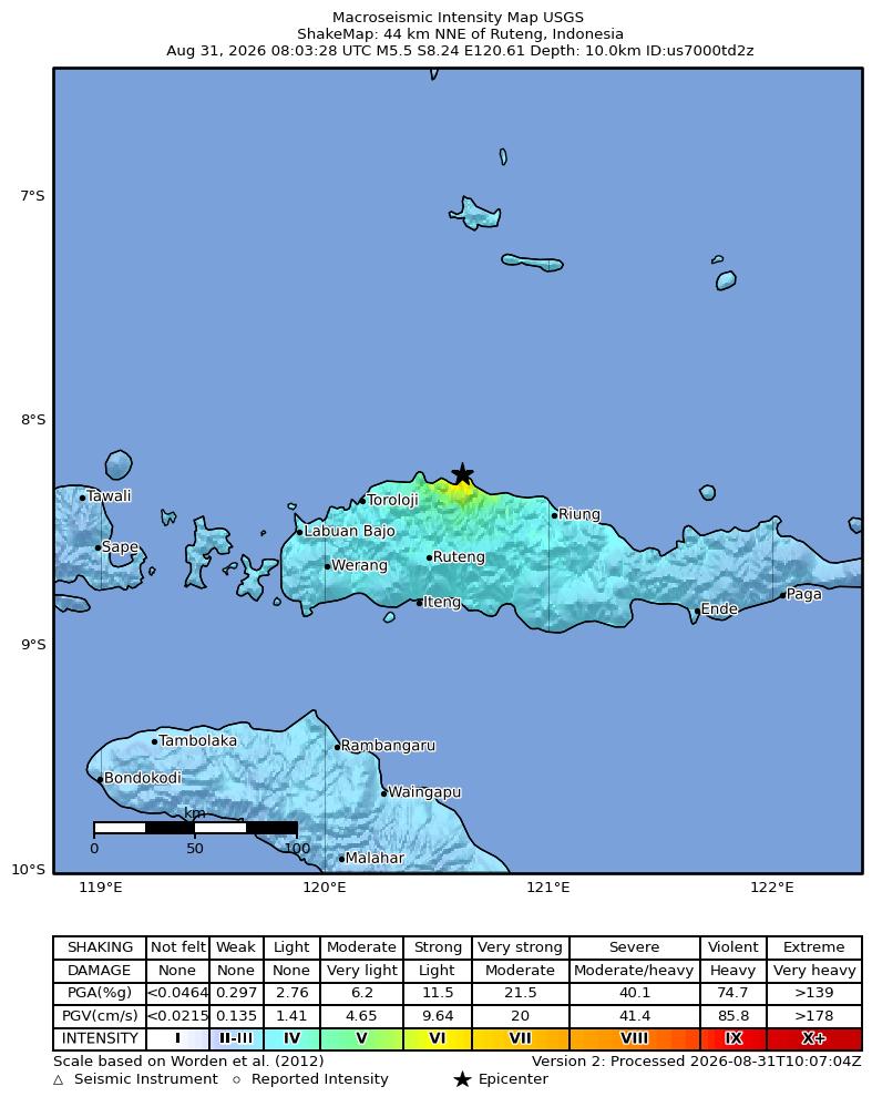
The U.S. Geological Survey reports a magnitude 5.5 earthquake 44 km north-northeast of Ruteng, Indonesia, at 4:03 AM EDT on 31 August 2026. Origin is 8.241°S, 120.6119°E, depth 10 km. The event is reviewed. PAGER fatality alert is green — USGS’s lowest alert for likely deaths. Tsunami flag is 0. ShakeMap maximum Modified Mercalli intensity is about 6.4.
Key facts
- Origin
- Aug 31, 2026, 4:03 AM EDT
- Magnitude
- 5.5 (mb)
- Type
- earthquake
- Coordinates
- 8.241°S, 120.6119°E
- Depth
- 10 km
- ShakeMap max MMI
- about 6.4
- PAGER
- green (lowest fatality alert)
- Tsunami
- 0
- Status
- reviewed
Green alert for shaking-related fatalities and economic losses. There is a low likelihood of casualties and damage.
USGS PAGER comments, us7000td2z
Note
USGS header: M 5.5 — 44 km NNE of Ruteng, Indonesia. Magnitude type is mb. Review status is reviewed. Network is us (NEIC). Geometry is 120.6119°E, 8.241°S, 10 km depth (depth type: operator assigned). PAGER product update used for this note: 31 Aug 2026, 6:12 AM EDT.
PAGER in plain language
PAGER estimates shaking-related deaths and economic losses. Green is the lowest of four colors. The official comment is low likelihood of casualties and damage. PAGER also states that population in this region resides in structures vulnerable to earthquake shaking, though resistant structures exist, and that recent earthquakes in this area have caused secondary hazards such as landslides. That is USGS wording, not a confirmed landslide report for this event.
This event
- PAGER fatality and economic alerts: green.
- Tsunami flag: 0.
- ShakeMap maximum MMI about 6.4 (strong), from the USGS product (maxmmi 6.406).
- Ground-failure product landslide and liquefaction alerts: green.
- This is an earthquake, separate from USGS us7000tbwb (Nepal glacial collapse) and us7000tcf3 (Somalia M6.0) already on this board.
Why it matters
A magnitude 5.5 under Flores is strong enough for damaging shaking near the origin — ShakeMap max MMI about 6.4 is strong, not light. PAGER is still green: an automatic likely-death alert, not a body count. Cite the USGS event page. This is a posted note with official coordinates, not a dump of the live M4.5+ feed onto the globe.
Sources
- USGS Earthquake Hazards Program
- USGS GeoJSON detail (us7000td2z)
- USGS event map
- USGS PAGER (us7000td2z)
Official data. Not a forecast. Endtimes badge not used on this note.