
official data
Rare Atacama snow runs Andes to Pacific — Landsat 8/9 and Terra, Aug 2026
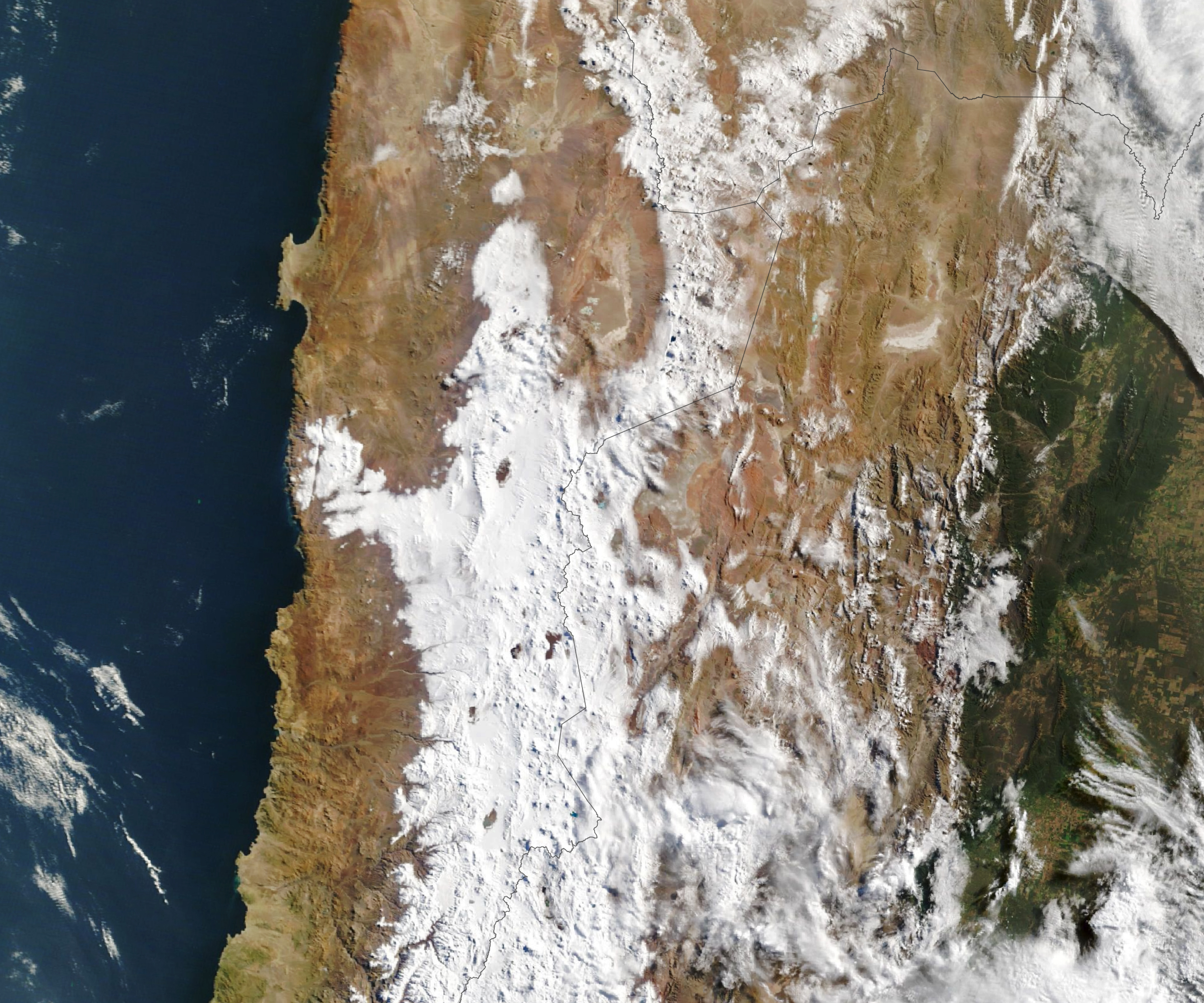
Back-to-back August 2026 winter storms left parts of the Atacama Desert under a rare snow cover, from the Andes toward the Pacific. NASA Earth Observatory’s Image of the Day for 27 August 2026 (no clock time on the page) uses Landsat 8 and Landsat 9 scenes of the Chajnantor plateau on 6 August and 14 August, then a Terra MODIS scene on 19 August that shows snow stretching west across the desert’s hyper-arid core to near the coast south of Antofagasta. ALMA suspended operations and moved antennas into survival mode. NASA frames the wet winter against a strengthening El Niño, citing CPC’s 13 August 2026 ENSO discussion. This is not Super El Niño language.
Key facts
- IOTD date
- Aug 27, 2026 (NASA Earth Observatory; no clock time on the page)
- Prior snow years named
- 2025 and 2011
- Landsat pair
- Landsat 8, 6 Aug 2026; Landsat 9, 14 Aug 2026; Chajnantor plateau / ALMA
- ALMA
- operations suspended; antennas in protective survival mode
- Terra MODIS
- 19 Aug 2026; snow Andes across hyper-arid core to near Pacific south of Antofagasta
- Taltal rain (Garreaud on NASA page)
- nearly 40 mm (1.6 in) in three days, about 10 times annual mean
- SENAPRED (as reported by NASA)
- thousands affected; hundreds of homes major damage from mudflows and flash floods
- ENSO framing
- strengthening El Niño as backdrop (Garreaud; NASA cites CPC 13 Aug 2026 discussion)
Totals reached a magnitude “rarely seen in the otherwise extremely arid region.”
René Garreaud, University of Chile, quoted by NASA Earth Observatory, 27 August 2026
Note
NASA Earth Observatory images by Lauren Dauphin, using Landsat (USGS) and MODIS (NASA EOSDIS LANCE / GIBS/Worldview). Story by Kathryn Hansen.
- 6 Aug 2026 Landsat 8: Chajnantor plateau mostly bare; ALMA array visible as a lighter patch.
- 14 Aug 2026 Landsat 9: same plateau snow-covered.
- 19 Aug 2026 Terra MODIS: snow from the Andes across the hyper-arid core to near the Pacific south of Antofagasta.
Why it matters
Snow in the Atacama is unusual enough that NASA published a dated satellite pair. SENAPRED’s thousands / hundreds of homes is NASA’s paraphrase of a disaster agency, not a fatality table. No Super El Niño language. Distinct from held Plains/ENSO notes.
Sources
- NASA Earth Observatory, Image of the Day
- NOAA CPC ENSO Diagnostic Discussion, 13 Aug 2026 (cited on the NASA page)
Official data. Not a forecast. Endtimes badge not used on this note.