
official data
Petermann ice island survives Joe Island hit — Landsat 9, Aug 23–24
NASA Earth Observatory’s Image of the Day for 1 September 2026 tracks the August 2026 Petermann ice island after it rammed Joe Island (Joe Ø) at the Petermann Fjord / Nares Strait junction. Landsat 9 OLI images from 23–24 August 2026 show the berg pivoting past the island without further fragmentation. At calving on 4 August the ice island measured just over 76 km² — the largest Arctic glacier calving since 2020 and Petermann’s largest since 2012 (130 km²). Story by Kathryn Hansen; images by Lauren Dauphin using USGS Landsat data.
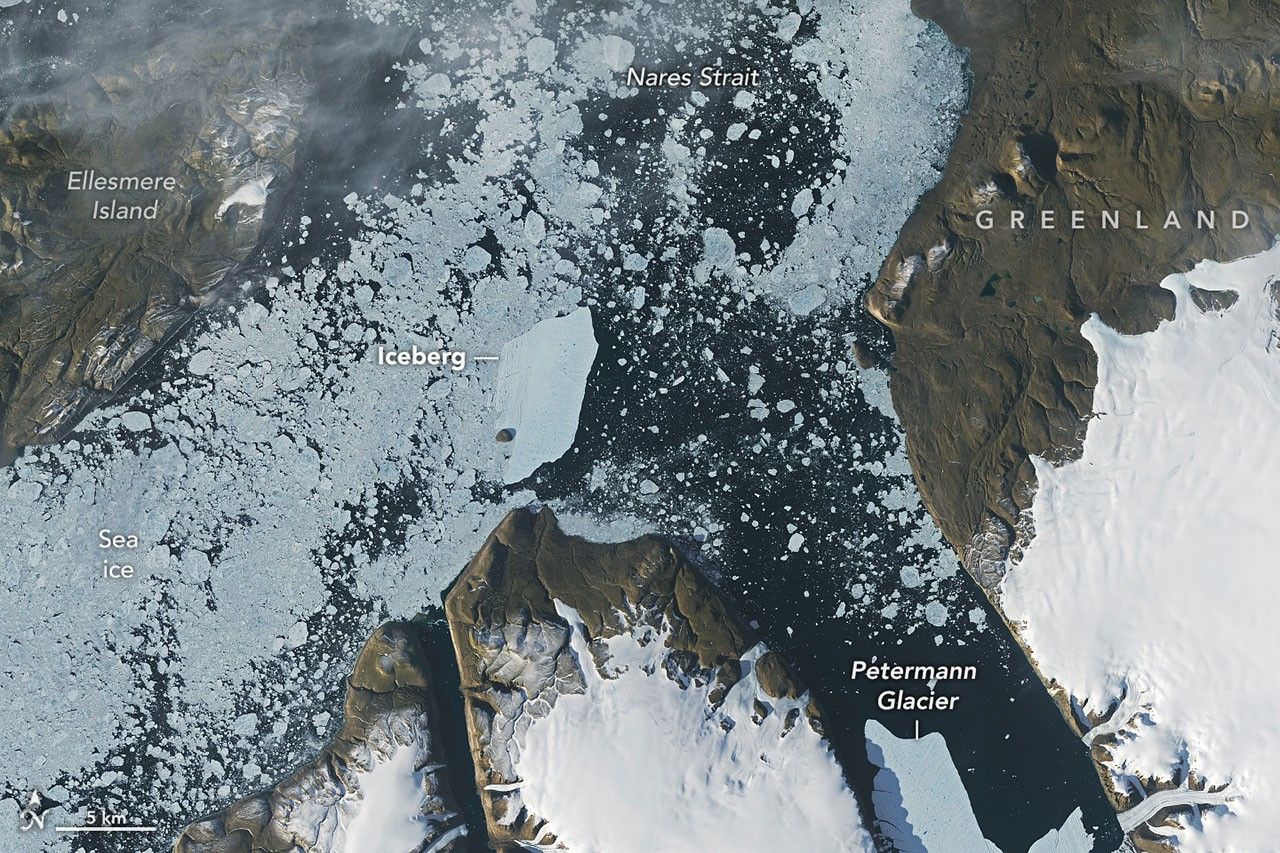
Key facts
- IOTD date
- Sep 1, 2026 (NASA Earth Observatory; no clock time on the page)
- Calving size
- just over 76 km² at Aug 4 calving — largest Arctic glacier calving since 2020; Petermann largest since 2012 (130 km²)
- Landsat 9
- OLI scenes Aug 23–24, 2026 at Petermann Fjord / Nares Strait junction with Joe Island
- Drift / thickness
- ~3 km/day average in the week after calving; thickness estimated <150 m
- Remaining rifts
- two additional rifts could later yield ~94 km² and ~84 km² ice islands (timing uncertain)
- Credits
- Story Kathryn Hansen; images Lauren Dauphin using USGS Landsat data
We were certainly watching closely as it interacted with Joe Island and were impressed that it survived the interaction without further fragmentation.
Adam Garbo, via NASA Earth Observatory, Sep 1, 2026
Note
Iceberg calving is a routine part of an outlet glacier’s life cycle. Petermann is one of Greenland’s largest marine-terminating glaciers and acts as a gatekeeper for ice flowing from the ice sheet into the ocean; NASA notes its future stability has implications for sea level rise.
The August 2026 calving was spotted on August 4 in ESA Sentinel-1 imagery. Collisions with Joe Island have previously split Petermann ice islands; this berg survived the Aug 23–24 encounter and continued southwest through Nares Strait.
- Official product: NASA Earth Observatory Image of the Day, Sep 1, 2026
- Sensor: Landsat 9 OLI (USGS/NASA)
- Place: Joe Island (Joe Ø), northwest Greenland
Why it matters
Brand-new Sep 1 NASA EO follow-up with official Landsat figures on the Petermann berg’s Joe Island collision — a sourced Greenland ice-loss signal for the climate rail, not a panic headline.
Sources
- NASA Earth Observatory, Image of the Day
- ESA Sentinel-1 (cited on NASA EO page for Aug 4 discovery)
- Fahrner et al. 2026, Science Advances (cited on NASA EO page)
Official data. Not a forecast.