
official data
USGS: M 6.0 north of Caluula, Somalia — major quake, PAGER still green, tsunami flag 0
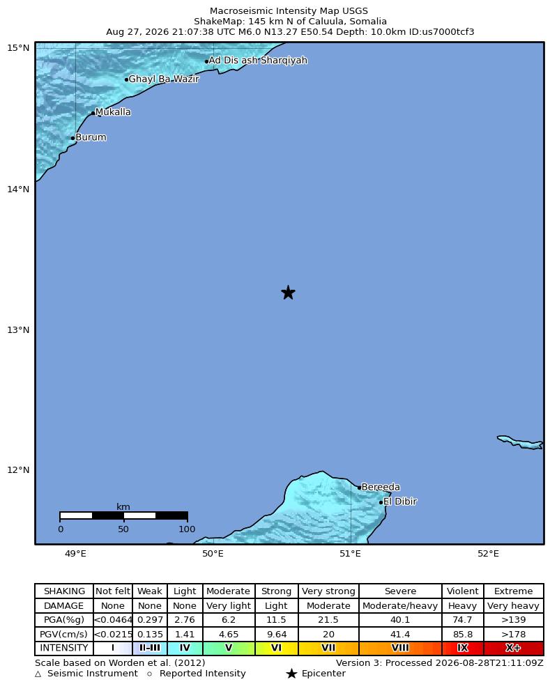
The U.S. Geological Survey reports a magnitude 6.0 earthquake 145 km north of Caluula, Somalia, at 5:07 PM EDT on 27 August 2026. Origin is 13.2654°N, 50.5425°E, depth 10 km. The event is reviewed. The Prompt Assessment of Global Earthquakes for Response (PAGER) fatality alert is green — USGS’s lowest alert for likely deaths. Tsunami flag is 0.
Key facts
- Origin
- Aug 27, 2026, 5:07 PM EDT
- Magnitude
- 6.0 (mww)
- Type
- earthquake
- Coordinates
- 13.2654°N, 50.5425°E
- Depth
- 10 km
- PAGER
- green (lowest fatality alert)
- Tsunami
- 0
- Status
- reviewed
Green alert for shaking-related fatalities and economic losses. There is a low likelihood of casualties and damage.
USGS PAGER comments, us7000tcf3
Note
USGS header: M 6.0 — 145 km N of Caluula, Somalia. Magnitude type is mww (moment magnitude from W-phase). Review status is reviewed. Network is us (NEIC). Geometry is 50.5425°E, 13.2654°N, 10 km depth.
PAGER in plain language
PAGER stands for Prompt Assessment of Global Earthquakes for Response. After a significant earthquake, USGS estimates how many people felt strong shaking and, from that, the likelihood of deaths and dollar losses. Alerts are color-coded. Green means little to no estimated fatalities and economic losses — the lowest level. Yellow, orange, and red step up from there. PAGER is not a confirmed casualty report.
This event
- PAGER fatality and economic alerts: green. Official comment: low likelihood of casualties and damage.
- Tsunami flag: 0 (no USGS tsunami product for this event).
- ShakeMap maximum Modified Mercalli intensity about 3.9 (light), from the USGS product.
- This is an earthquake, not a landslide. It is separate from USGS us7000tbwb (Nepal glacial collapse) on this lane.
Why it matters
PAGER is USGS’s automatic estimate of shaking-related deaths and economic losses, not a body count. Green is the lowest of four colors (green, yellow, orange, red). A magnitude 6.0 in a remote offshore/coastal setting can still be felt; this product says the likely-death alert is the lowest level and the tsunami flag is 0. Cite the USGS event page, not a headline that invents casualties. Magnitude 6.0 is a major earthquake; this product still gives the lowest fatality alert and no tsunami flag.
Sources
- USGS Earthquake Hazards Program
- USGS GeoJSON detail (us7000tcf3)
- USGS event map
- USGS PAGER (us7000tcf3)
Official data. Not a forecast. Endtimes badge not used on this note.