
official data
USGS: M5.8 quake hits Kermadec Islands off New Zealand
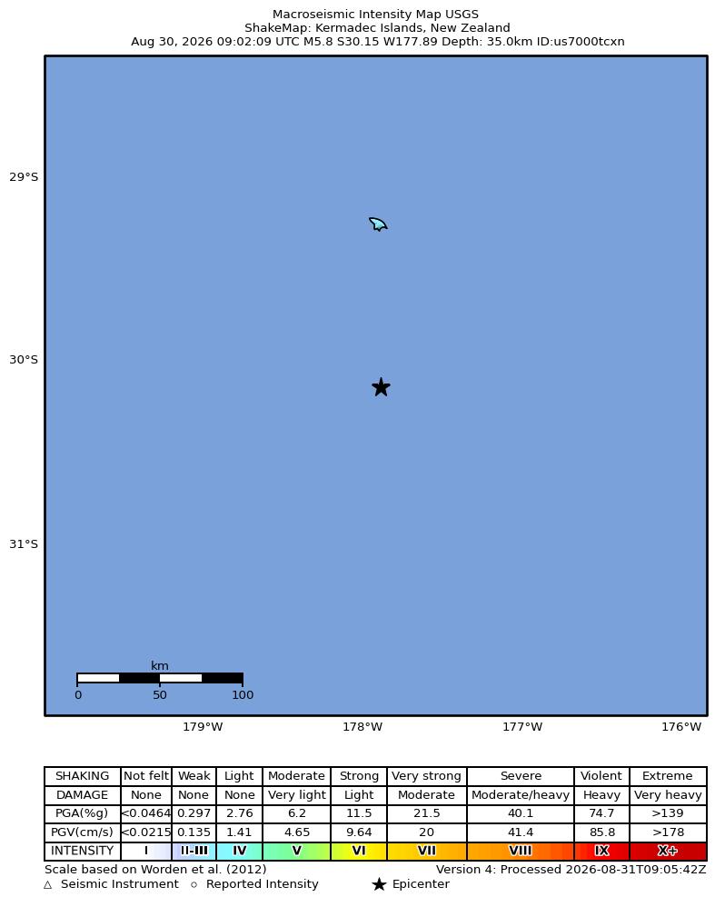
The USGS National Earthquake Information Center lists a reviewed M 5.8 earthquake in the Kermadec Islands, New Zealand, origin 30 August 2026 at 09:02:09 UTC (Sunday, 5:02 AM ET). Official coordinates: 30.1462°S, 177.8882°W, depth 35 km, event id us7000tcxn. ShakeMap intensity JPEG is an official USGS product (product timestamp 31 August 2026, 09:07 UTC / 5:07 AM ET). PAGER is green. Tsunami flag is 0. This is subduction-zone seismicity. It is not a pole reversal and not proof of ECDO.
Key facts
- Magnitude
- preferred M 5.8; status reviewed; event id us7000tcxn
- Origin
- 2026-08-30 09:02:09 UTC = Sun Aug 30, 2026 5:02 AM ET
- Location
- 30.1462°S, 177.8882°W; depth 35 km; Kermadec Islands, New Zealand
- PAGER / tsunami
- alert green; tsunami 0
- Moment tensor (USGS Mww, preliminary, as in scout packet)
- Mww 5.5; scalar moment 2.37E+17; percent DC 0.9098; derived depth 50.5 km
- ShakeMap
- maxMMI 4.295 (scout packet); intensity.jpg confirmed JPEG from USGS PDL
Kermadec Islands, New Zealand
USGS eventpage place string, us7000tcxn
Note
Origin from USGS GeoJSON time 1788080529229. Coordinates are official NEIC, not estimated.
Why it matters
Strongest USGS-reviewed past-week M4.5+ event not already on live notes after Somalia M6, Ruteng, and Nepal. Official green PAGER. Keep ECDO off the USGS conclusion.
Sources
Official data. Not a forecast. Endtimes badge not used on this note.