
official data
USGS: M5.6 quake rocks North Maluku seas off Maba
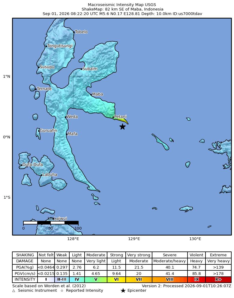
The USGS National Earthquake Information Center lists a reviewed M 5.6 earthquake 82 km SE of Maba, Indonesia, origin 1 September 2026 at 08:22:20 UTC (Tuesday, 4:22 AM ET). Official coordinates: 0.1685°N, 128.8054°E, depth 10.0 km, event id us7000tdav, magnitude type mb. ShakeMap intensity JPEG is an official USGS product. PAGER is green. Tsunami flag is 0. Ground-failure landslide and liquefaction alerts are green. This is regional seismicity. It is not a pole reversal and not proof of ECDO.
Key facts
- Magnitude
- preferred M 5.6 mb; status reviewed; event id us7000tdav
- Origin
- 2026-09-01 08:22:20 UTC = Tue Sep 1, 2026 4:22 AM ET
- Location
- 0.1685°N, 128.8054°E; depth 10.0 km; 82 km SE of Maba, Indonesia
- PAGER / tsunami
- alert green; tsunami 0
- Ground failure
- landslide alert green; liquefaction alert green (USGS product)
- ShakeMap
- maxMMI 6.228; intensity.jpg confirmed JPEG from USGS PDL
82 km SE of Maba, Indonesia
USGS eventpage place string, us7000tdav
Note
Origin from USGS GeoJSON time 1788250940813. Coordinates are official NEIC, not estimated. Product set includes origin, shakemap, losspager, and ground-failure.
ECDO (Exothermic Core-Mantle Decoupling / Dzhanibekov Oscillation) remains a tracked hypothesis. A single M5.6 in North Maluku is ordinary plate-boundary seismicity and is not evidence that ECDO is proven.
Why it matters
First new USGS-reviewed M5.5+ since the live Ruteng and Kermadec notes, with an official Sep 1 event page. Official green PAGER. Keep ECDO off the USGS conclusion — seismicity only.
Sources
Official data. Not a forecast.